Hi everybody,
Unfortunately it took me quite some time to get the third New Zealand entry done, since after quick stops in Sydney and Bangkok, the Internet connections in Myanmar and Laos haven't been the best and I figured out as well, that there was a lot happening on the second half of my trip to New Zealand which brought me to the South Island:
The journey from Wellington to Picton is a ferry ride of a bit more than three hours leading from the Oriental Bay through the Marlborough Sounds - a maze of little islands.
The ferry-ride was quite windy and the south didn't welcome me with good weather, the sky was covered with clouds
On the arrival in Picton, I met Hendrik, a guy from Hamburg, who was traveling on his own as well and whom I gave a ride to our first hostel in Nelson. At the end it turned out that he joined me for the entire trip on the south island. (there will be bigger pictures from him ;-)
In Nelson we had planned a two day trek through the Abel Tasman NP but the weather was not on our side and foresaw rain for four days out of five. (and this region supposed to be the sunniest place in New Zealand!)
Unfortunately not having that much time to wait, we had to cancel the trekking and continued with big steps ...
to drive down the west coast in the hope of better weather.
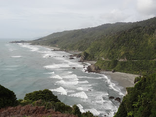
This part of the country is very interesting. Following Hendrik on his path to the ocean, he passes first dschungel-like forest, turning into lighter forest, becoming agavefields before reaching the sea.
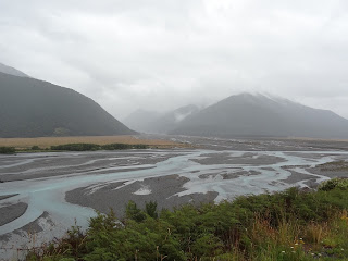
As you can see in the pictures, the weather did not improve and the forecast convinced us neither so that we decided to cross the mountains and drive from Greymouth on the Westcoast over the Arthur's Pass to Christchurch in the east ... a ride through clouds and rain ... we didn't see much of the landscape.
Arriving in Christchurch was quite shocking. Everybody has probably heard about the heavy earthquakes in 2010 and 2011 - and you still notice it everywhere. (e.i. tower top roofs that came off.)
Big parts of what was the former downtown area (around the cathedral) is even completely closed.
For the 185 dead of the earthquake in 2011 (in 2010 luckily nobody died) there is an installation of 185 different, white painted chairs.
Despite the destruction still visible in many parts of the city there are also projects for a "restart" as this small shopping mall made out of shipping containers.
Due to the destruction of the big hotels in the center, the city's capacity on accommodation is not restored yet so that we found ourselves on the campground.
and as everything was packed on the next morning, the sun came out for a first time for a long time.
Our destination for the day was Akaroa on the Banks Peninsula, ...
And while Hendrik took care about our dinner (we had a great fish) ...
... I visited Akaroa, a former french settlement (still visibel at some corners)
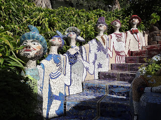
It's an idyllic village with one house a bit different than all the others ...
It's the colorful house of an artist who has built a fantasy garden around it.
... to drive a bit inland approaching the snowcovered mountains of the southern Alps for the first time.
As often, the weather changes during the day and so we had some sun as we arrived back on the coast at the Moeraki Boulders, some huge natural cannonballs laying on the beach.
Arrived in Dunedin, we had to check out this student town with its special historic touch, and his Railway station in Victorian Style, housing in its inside also the New Zealand Sports Hall of Fame.
of course by driving up ...
... and down :-)
Afterwards we headed out to the Otago Peninsula.
The island is known for its albatrosses and penguins, but at the end - together with two french people we met in Dunedin, we "just" saw seagulls, sealions and one or two penguins from a distance.
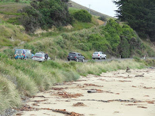
The next day lead us through the Catlins - a coaststrip in the very south of the South-Island. A day that begun with another encounter with a sealion.
And if this happens next to the road, you can be sure that you are never the only witnesses :-)
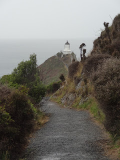
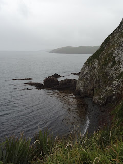
What makes the catlins so spectacular is its variety. You got amazing views over the coastline that changes from cliffs to beaches ...
You even have some grassland stretching to the sea giving food for the great number of sheeps we saw on the way
And you can not only find sheep, but fish as well!
You cross many rivers ...
.... water that went down some amazing waterfalls before flowing in the ocean.
And at the end of the day we even saw some penguins at Curio Bay!!
After a quick stop at Slope Point - the windy, most southern spot of New Zealand ...
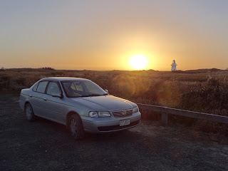
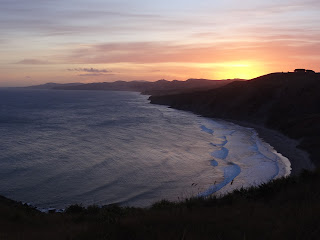
we had a beautiful sunset at Waipaga Point.
The Catlins is not a very populated area and therefore we should have known that gas-stations might close before 10pm (sunset time) ... And since we did not have sufficient gas to make it to the next bigger city we found ourselves in Tokanui where we made the best out of the situation, having a great sandwich, beer and chat with the four people hanging out in the local tavern besides us.
The night we slept on the local playground ...
before getting some new gas the next day.
That day, it was not the only time we needed some new gas since it was a long ride going up all the way into the fjordlands ...
to one of the most spectacular sites on this trip, the Milford Sound (which, even though he was surrounded by fog, looked great!)
It was night when we arrived in Queenstown and Hendrik and I split up for two days, since he wasn't too keen on the hiking trip I planned on doing: the Routeburn Track. So I went off alone and it finally payed off that we changed the entire travel route to wait until the last moment to come to the fjordlands: the weather was just amazing!
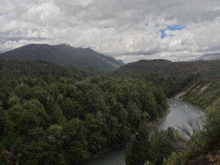
The track starts in the forest, ...
... crossing rivers ...
and every once in a while already gives you views of the high snowcovered mountains.
At the second hut - the Routeburn Falls Hut - I had my first break next to the waterfall
and continuing further I felt like over the rainbow ... the trees stopped entering a world of mountaintops and lakes.
On the highest point of the trek - Conical Hill - you had a view deep into the fjordlands and at the end of the valley you could even see the ocean - the Tasman Sea.
The second part went down along a valley ...
passing Lake Mackenzie ...
and as I reached a waterfall 1 hour away from my hut, the sun was already quite low.
and to get back to the Milford Sound I wanted to see a second time during daylight and if possible without clouds. Both was the case but a big cruise ship anchored in the sound. Fortunately it just took off before our boattrip started ...
so on the way back, we had a great view of the sound and a sealion-company taking a bath in the sun.
I hitchhiked back to Queenstown, a city made for travelers and tourists, offering all sorts of Outdoors activities and similar to European ski resort villages having a big variety of bars.
And the evening/night we spent in different bars e.i. in the cowboy bar, riding the bull and with the two people who gave me the ride back to Queenstown.
The next day we set off to the last big point on the trip, Fox and Franz Josef Glaciers on the Westcoast. Hendrik used this ride to recover a bit from the nights in Queenstown but was more than awake as we reached Franz Josef Village having a first glimpse on the glaciers.
Franz Josef Glacier you can just see from the distance but you can walk up to the edges of the Fox Glacier.
Leaving in Geneva on the edge of the alps, glaciers are not a new thing to me but the interesting point about the glaciers in New Zealand are its setting having forest around it and being in such a short distance to the ocean, ...
a fact I had to see from the air, ...
in company of Lee, who instructed me on my first skydive.
Already the flight was impressive, seeing the river bed of the Waiho River that flows directly from the Franz Josef Glacier and the open coastline on one side and Mt. Cook and the tops of the southern Alps on the other.
Not to speak about the way back to the ground! After a flip out of the airplane it was an amazing fall from 18000 feet.
After a night in Greymouth I dropped Hendrik off in Nelson, where it took us a while separating the stuff after traveling together for almost two weeks.
A time I really enjoyed! Thanx a lot Hendrik for all these moments!
It was a bizarre feeling to be alone on the road again but the beautiful ferry cruise back to the North Island brought me quick on other ideas. It was a gift, especially if you compare the pictures with the ones from the first ferry ride on the top of this report.
Leaving the Marlborough Sounds on the South Island, you had such a clear view that you could even see the North Island in the distance!
And as the sun went down on one side ...
... the moon already rose on the other.
... and after midnight as I reached Chrissy's house in Masterton where I planned on staying the last two days of my time in New Zealand.
After an amazing breakfast and some time in Masterton ...
we had off to Castelpoint, where we had a fun day and an amazing sunset in the evening!
The second day Chrissy brought me to the south coast and gave me a lesson on how to catch paua (a shell living in the ocean) and how to prepare them to eat.
Even though the pictures might illustrate it a bit differently, at the end, Chrissy did all the work apart from carrying the knife (that yellow thing on my leg) and building the shelter to protect us a bit from the heavy sun, which my profession obliged me to do :-)
After a quick stop at the Putangirua Pinnacles, we had a nice drive home in the evening sun.
The next day I had to drive from Christina's house up to Auckland, passing one more time the Tongariro National Park, to catch the plane to Sydney
In the hope you are all doing fine, I send you beloved greetings!
Boris


