Kia ora for the second time ...
... and unfortunately it took me quite a while to get my second report done. Nevertheless I hope you enjoy the images of the second week that brought me from Auckland to Wellington.
The bus from Otorohanga (where Chrissy dropped me off) stopped directly at the Skytower, apparently the highest building in the Southern Hemisphere.
It is a landmark throughout Auckland ...
and determines the skyline by day ...
and by night!
Looking up the Skytower from below is one thing, ...
but I couldn't resist to also see the city from its top floor.
(view on CBD and Viaduct Harbour, a zone that first got developed for the Americas Cups in 1999/2000 & 2003 and then in 2011 for the Rugby World Cup)
But in Auckland there is more to see than just the Skytower. The town is founded on a vulcanic field and the numerous vulcanic cones once served the Maori as Pa (fortified villages) whose terraces are still visible until today in Aucklands parks (i.e. one tree hill in Cornwall Park).
For a short period of time (1840 - 1865) Auckland was the Capital of NZ. The Old Government House dates back to this time.
And below some more impressions of the town, which is the biggest in New Zealand with a populaton of 1,4 Million (of 4,4 Mio. in NZ!!)
The civic theater - one of seven remaining "atmospheric theaters" in the world ... unfortunately wasn't able to get in.
And I found even some witnesses of the German Heritage in New Zealand!


and six people (I tried to help as well :-) to get the car out after about an hour!

The bay of Island is also known for the Treaty of Waitangi, which declared New Zealand a British Colony and regulated the Maori-British relation and apparently still is the base for race relations in NZ today.
On the ground you find the Treaty House ...
and whare runanga, a Maori meeting house (with some Maori giving a traditional welcome ceremony)
On the treaty grounds, there is also displayed a 35m long Maori war canoe, which was carved out of one tree, ...
... which stump you can see below.
where you can hangout way longer than I did.
Asthetically maybe a bit bizarre to find a Hunderwasser in NZ
but from the functional point of view ... it works!!
... and an hour later covered the entire sky.
No good signs for the Tongariro Alpine Crossing (a walk through an still active vulcanic site), that I wanted to do that day.
Reaching the information center in the National Park, they told me that the weather should get better in the afternoon but that I already missed the last shuttle that brings the tourist to the car park, and picks them up again later on the day.
Hoping that the weather forecast was right (what probably caused that big smile on my face) I parked the car on the closest point to the carpark (=shuttle drop off) and walked the seven remaining kilometers.
The weather though was quite bad and it was impossible to see something of the vulcanic mountains in front of you.
Nevertheless there were some happy moments as I remet for example two swiss who I already met on the campground where I celebrated New Year with Christina, Torsten and Franzi.
In the hope that the weather would get better, I waited as long as possible to start the 6-7 hour walk, which is normally a crossing but due to an irruption in August / November 2012 is blocked after a bit more than the middle.
But the weather did not change much the first hour
All of a sudden though, there were blue, sunny holes in the sky, ...
opening the view on a bizarre but great landscape.
There were hardly any people left on the track. But I met a funny norwegian couple with whom I tramped the rest of the track.
Not having seen much on the way in, we discovered the snowcovered Mt. Ruapehu as well as Mt. Taranaki about a 150km away on the Westcoast.
And the detour was absolutely worth the effort having a clear and fantastic view on Mt. Taranaki, an almost singular standing vulcanic cone, which often hides behind some clouds.
Unfortunately, I just had one night in Wellington and the time until the ferry ride to the south Island on the next day I spent by visiting the national parliament.
... and unfortunately it took me quite a while to get my second report done. Nevertheless I hope you enjoy the images of the second week that brought me from Auckland to Wellington.
The bus from Otorohanga (where Chrissy dropped me off) stopped directly at the Skytower, apparently the highest building in the Southern Hemisphere.
It is a landmark throughout Auckland ...
and determines the skyline by day ...
and by night!
Looking up the Skytower from below is one thing, ...
but I couldn't resist to also see the city from its top floor.
(view on CBD and Viaduct Harbour, a zone that first got developed for the Americas Cups in 1999/2000 & 2003 and then in 2011 for the Rugby World Cup)
But in Auckland there is more to see than just the Skytower. The town is founded on a vulcanic field and the numerous vulcanic cones once served the Maori as Pa (fortified villages) whose terraces are still visible until today in Aucklands parks (i.e. one tree hill in Cornwall Park).
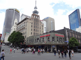
The University Clock Tower and the St.Patrick's Cathedral date back to the early 20th century.
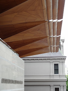
But there is also some interesting modern Architecture as the extension of the Auckland Art Gallery (architects: fjmt + archimedia) in Albert Park.
And below some more impressions of the town, which is the biggest in New Zealand with a populaton of 1,4 Million (of 4,4 Mio. in NZ!!)
The civic theater - one of seven remaining "atmospheric theaters" in the world ... unfortunately wasn't able to get in.
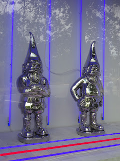
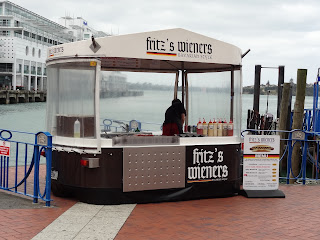
And I found even some witnesses of the German Heritage in New Zealand!
From Auckland I drove up north: Cape Reinga, the most northern point on the island.

I arrived there for sunrise but as you can see on the clouds ... definately not a good day to see the sun go up. Nevertheless, breakfast was great ;-)
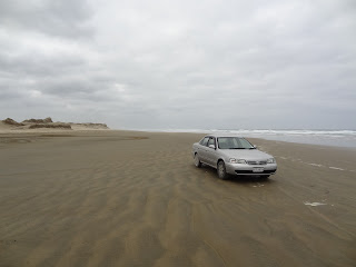
The weather did not change much as I arrived at the 90 Miles Beach, a beach where it is just impossible to see its end.
Time also to present you the car that will hopefully accompany me the next three weeks: a Nissan Sunny SuperSaloon (just love the name) - one of the typical tourist rental cars they have here.
Three other Germans also wanted to shoot a nice picture with their car ... just got stuck in the sand
And in the end it took another car, ....
... lots of work, ...
and six people (I tried to help as well :-) to get the car out after about an hour!
Driving further south, the weather got better and better. The landscape is a bit similar to what we know in Central Europe.
Approaching the Bay of Islands, you pass old buildings indicating that you approach the oldest region of European settlement in New Zealand.
The bay of Island is also known for the Treaty of Waitangi, which declared New Zealand a British Colony and regulated the Maori-British relation and apparently still is the base for race relations in NZ today.
On the ground you find the Treaty House ...
and whare runanga, a Maori meeting house (with some Maori giving a traditional welcome ceremony)
The insight of these houses is always similar and alternates in between carvings and weavings.
On the treaty grounds, there is also displayed a 35m long Maori war canoe, which was carved out of one tree, ...
... which stump you can see below.
A part from its historical significance, the Bay of islands is a wonderful spot, ...
where you can hangout way longer than I did.
Instead I wanted to head south again as I saw the following sign:
Asthetically maybe a bit bizarre to find a Hunderwasser in NZ
but from the functional point of view ... it works!!
From the Bay of Islands I drove past Auckland to Lake Taupo. I slept there a night and on the next morning, the clouds hardly let the sun rise, ...
... and an hour later covered the entire sky.
No good signs for the Tongariro Alpine Crossing (a walk through an still active vulcanic site), that I wanted to do that day.
Reaching the information center in the National Park, they told me that the weather should get better in the afternoon but that I already missed the last shuttle that brings the tourist to the car park, and picks them up again later on the day.
Hoping that the weather forecast was right (what probably caused that big smile on my face) I parked the car on the closest point to the carpark (=shuttle drop off) and walked the seven remaining kilometers.
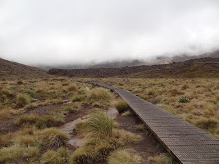
The weather though was quite bad and it was impossible to see something of the vulcanic mountains in front of you.
As I arrived at the car park's shelter, it was crowded with people that had tried to go up but came back completely wet and disappointed (lots of rain, lots of wind, no sight) and now waited for the shuttles to pick them up.
Nevertheless there were some happy moments as I remet for example two swiss who I already met on the campground where I celebrated New Year with Christina, Torsten and Franzi.
In the hope that the weather would get better, I waited as long as possible to start the 6-7 hour walk, which is normally a crossing but due to an irruption in August / November 2012 is blocked after a bit more than the middle.
But the weather did not change much the first hour
All of a sudden though, there were blue, sunny holes in the sky, ...
opening the view on a bizarre but great landscape.
Even Mt. Ngauruhoe (better known as Mt. Doom in Peter Jackson's Lord of the Rings) became visible.
There were hardly any people left on the track. But I met a funny norwegian couple with whom I tramped the rest of the track.
Reaching the end of the track at the Emerald Lakes, there were still clouds, ...
that completely disappeared on our way back.
And the shelter at the car park ... now quiet and empty in the landscape.
Not having seen much on the way in, we discovered the snowcovered Mt. Ruapehu as well as Mt. Taranaki about a 150km away on the Westcoast.
To go to Wellington, I decided not to drive directly south but take a detour to pass by Mt. Taranaki that brought me on the forgotten World Highway 43. An amazing road leading me through the first car tunnel I have seen on the Northern Island so far.
And the detour was absolutely worth the effort having a clear and fantastic view on Mt. Taranaki, an almost singular standing vulcanic cone, which often hides behind some clouds.
Reaching Wellington in the afternoon, the weather was still nice and therefore I decided to take the cablecar up to the Wellington Botanic Gardens:
a lane that leads from the city center ...
... to the top of an hill from where you have a nice view over the city.
An interesting aspect I found in the cablecar!
From the top of the hill you can walk back to the city through the gardens, passing a Henry Moore statue and the old Wellington cemetary, being just a couple meters away from todays CBD.
In the evening I came back to the gardens since there are live concerts almost all summer long. A great experience - due to the concert and the ilumination of the garden.
Unfortunately, I just had one night in Wellington and the time until the ferry ride to the south Island on the next day I spent by visiting the national parliament.
Early afternoon, it was time to get on the ferry to ship me over to the South Island.
Leaving two amazing first weeks behind, I was very curious about New Zealands South, which will also be the next chapter on this blog. I hope it does not take me that long as this time to get it done ;-)
Hope you all are doing and sending beloved greetings from New Zealand!
Boris











6 Kommentare:
Hey! Ganz tolle Fotos wieder!
Hab einen guten Trip !!
LgF
Did you see the Hobbitses!!?
Hey Bo! Coole Story und Bilder! Warst du schon in den Waitekeres? Gruesse vom Schloss!
Hi dear!!
Veo que estás disfrutando de tu aventura...bonitas fotos, te falta algo de gastronomía, folklore y colorido, no? Seguro que hasta en NZ tienen de eso...bueno, seguro que en Thailand, Vietnam...se te suben los colores!! Buen viaje...
Un beso
Izaro
boris,
die bilder kenn ich nun schon! ich schau sie mir immer weider an, weil ich darauf warte wieder von dir zu hören. schick uns neue tolle bilder und ein update, wo du nun auf tour bist... bitte!
liebe grüße, pass auf dich auf und gute weiterreise,
sarahdg
Geniale Fotos, Boris! Freue mich schon auf den nächsten Post!
Grüße aus dem Ruhrgebiet von Andrea
Kommentar veröffentlichen